Reimagining

Trichy’s Teppakulam Precinct

A National level open ideas urban design competition

Image credit: Maniyarasan R

About Teppakulam

Trichy’s Teppakulam, built in the 17th century A.D., and spread over 5 acres, is one of the largest temple tanks in South India. It holds a historical and cultural significance in Trichy. It is also one of the largest open spaces in the heart of the old city.

The Teppakulam and its precinct also contain several of Trichy’s historic buildings. Over the years, the significance of Teppakulam has been greatly reduced by the uncontrolled proliferation of commercial activities and encroachments along its edges. The Teppakulam and its precinct, once the cultural heart of the city, is now largely absent from the public image of the city.

reimagining the precinct

The Trichy City Corporation has recently cleared the encroachments from the Teppakulam’s edge. This presents an opportunity to reimagine and redevelop the precinct as one of the most recognisable, multi-use, & vibrant public space in the historic heart of Trichy.

Reimagining Teppakulam would also be an exercise in participatory planning, with surveys, stakeholder engagement and visioning workshops with stakeholders, govt. officials, and design professionals. It culminates in a ‘National-Level Open Ideas Urban Design Competition’ to generate contextual yet innovative ideas in redeveloping one of Trichy’s important heritage asset.

Can we

Restore the Teppakulam precinct as a cultural symbol of Trichy?

Revive it as an effective piece of Trichy’s water management system?

Reclaim the precinct as a vibrant public space in the heart of the city?

Reintegrate it into the cultural, social, and urban fabric of Trichy?

Updates

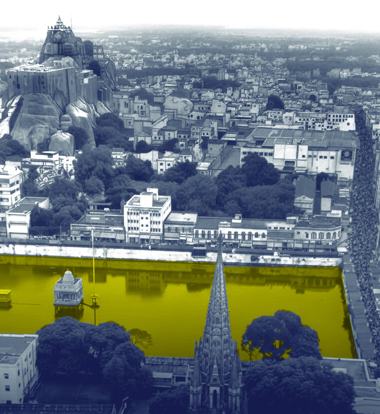
Trichy Fort – Then & Now

Some of the detailed maps of Trichy Fort are from the colonial era, made successively by the French and the English during the 18th century. One of the most detailed maps of Trichy fort with all its essential components was a map drawn by the French in the mid to late eighteenth century. The morphology…

Aerial mapping & photogrammetry

Over the weekend (21, 22 March), aerial photography and building ground-use mapping were conducted. The aerial photos would be the basis of photogrammetry of the Teppakulam and the inner fort area of Trichy fort. Ar did the documentation and photogrammetry. Maniyarasan, of CARE School of Architecture.


Timeline

Signup for updates

Receive all updates on the competition and related activities in your inbox